Surface Water Runoff
The lower Jordan River and several Wadis along the Dead Sea shores in Jordan, Palestine and Israel are filled with fresh rainwater in the winter and rush down to the Dead Sea. The major side Wadis of the Dead Sea are Wadi Al-Hassa, Wadi Moujeb, Wadi Wala, Wadi Mukallak, Wadi Nar, Wadi Daraja, Wadi Ghar (David), Wadi Ze'elim, Wadi Rahaf, Wadi Heimar, Wadi Zin And Wadi Northern Arava. The Lower Jordan River and the Wadis along the Dead Sea shores rushed fresh rain water unchecked into the Dead Sea. Today, the major Wadis are dammed and several others are also filled with domestic and industrial wastewater. The Lower Jordan River once discharged 1,320 MCM but now discharges less than 250 MCM of bad quality water.
The Lower Jordan River
The lower Jordan River Basin extends from lake Tiberia to the Dead Sea. The major tributaries for the Lower Jordan River are the Yarmouk River and Zarqa River. The Lower Jordan River also receives stream runoff from deeply incised wadis that cross the eastern and western escarpments from the Mountain Belt and Jordan Highland. However, most of the flow from the Upper Jordan (500 MCM), Zarqa (86 MCM) and Yarmouk Rivers (480 MCM) is diverted for water supply. In addition storm runoff water from several smaller catchments along the Lower Jordan are harvested for agricultural purposes.Table 1 shows the changes of water flows to the Lower Jordan River between 1930 and 2005.
Table 1. changes of water flows to the Lower Jordan River and the Dead Sea between 1930 and 2005
| |
Water Resources MCM (1930) |
Water Resources MCM (Recent) |
| Water Use in Hula* Marshes |
0 |
-130 |
| Upper Jordan River Discharges and Surface Runoff into Hula** and Tiberia |
720 |
720 |
| Hydrological Balance Tiberia Lake Basin |
80 |
80 |
| Precipitation over Tiberia Lake |
70 |
70 |
| Salty Springs |
44 |
44 |
| Yarmouk River Diversion Into Tiberia |
0 |
65 |
| Israel Local use and National Water Carrier |
0 |
-554 |
| Water Transferred to Jordan |
0 |
-45 |
| Evaporation and evapotranspiration from Hula** and Tiberia |
-250 |
-130 |
| Water Discharge from Tiberia to Lower Jordan River Basin |
664 |
120 |
| Yarmouk River |
420 |
20 |
| Zarqa River |
86 |
6 |
| Small Catchments on the Western Side |
35 |
28 |
| Small Catchments on the Eastern Side |
15 |
15 |
| Hydrological Balance Lower Jordan Basin |
204 |
0 |
| Wastewater and Return Flow from Agriculture |
0 |
60 |
| Evaporation from Springs and evapotranspiration |
-104 |
0 |
| Total Before Evaporation |
1320 |
249 |
| Water Flowing into the Dead Sea |
1320 |
249 |
* Water Use in the drained Hula marches for purposes of agriculture
** Evaporation and evapotranspiration from the Hula marches before Hula marshes were drained.
 Top Top
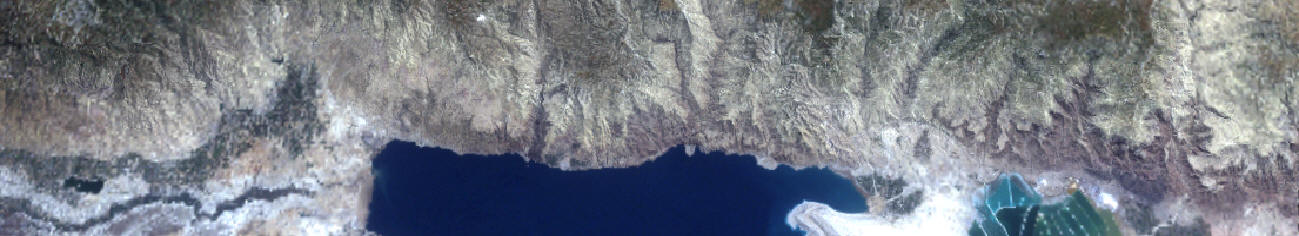
Side Wadis
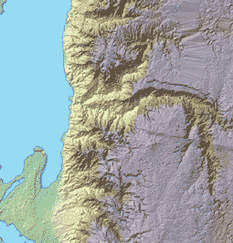
The major side Wadis of the Dead Sea are Wadi Al-Hassa, Wadi Moujeb, Wadi Wala, Wadi Mukallak, Wadi Nar, Wadi Daraja, Wadi Ghar (David), Wadi Ze'elim, Wadi Rahaf, Wadi Heimar, Wadi Zin And Wadi Northern Arava. The catchment area for each of the aforementioned Wadis and the average annual discharge are presented in Map 1.

Map 1. Major Wadis and their annual discharge into the Dead Sea
Annual Base flow and flood flow from the Wadis into the Dead Sea averaged 222 MCM. However, major water diversion project and agriculture around the Dead Sea Basin significantly lowered the flow. Indeed, two large water dams are constructed to divert stream flow in the eastern wadis, these area constructed on Wadi Mujib (Current Capacity 25 MCM) and and Wadi Hassa (8 MCM/yr). There exist plans to increase the capacity of Wadi Mujib Dam to 42 MCM/yr and to construct a third dam in Wadi Wala with a total capacity of 5 MCM/yr. The total volume of harvested water is planned to reach 55 MCM by the year 2010.
Surface Water Collection in Cisterns
Rainwater harvesting from rooftops or in rock catchments is a common practice in the Palestinian part of the study area. It mostly takes place at localities in the upper catchment area of the Dead Sea where precipitation in higher than 300 mm/yr. Domestic rainwater harvesting from rooftops is utilized as drinking water, for husbandry and for backyard gardening. The size of the domestic cisterns ranges between 50-80 CM and averages a size of 70 CM. Rock catchments harvesting in the study area is also a common practice and the water is entirely used for husbandry. The total volume of water collected in domestic cisterns is approximately 1.3 MCM/yr (Calculations based on PHG Data, WASH Project), whereas the total volume of water collected in rock catchments is approximately 25,000 CM/yr (Does not include the district of Jerusalem where no data is available). No rainwater harvesting from rooftops takes place in the arid Jordanian and Israeli parts of the study area.
Top |