The Project
Introduction
Is there a problem?,
Why is the Dead Sea Important?,
Objectives
Project main objective and specific objectives
Approach
Methods & Building
Blocks
Data collection and harmonization,
Scenario Development,
Synthesis,
Development of Options,
Integration,
Overview of Water Uses
Israel, Jordan and Palestine
Threats
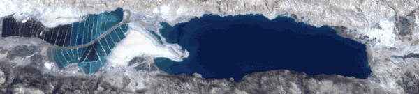
Dead Sea Water Level,
Groundwater level,
Sinks, etc
Factors
Over abstraction, Diversion of rivers, pollution,
etc |
Preliminary Results
Physiography
Location and Topography
Climate
Precipitation, Evaporation, Temperature and Relative Humidity
Surface Water
Watersheds, Surface water flow, surface water quality, etc
Groundwater
Volume of water abstracted from wells, water quality, location of
water springs, etc
Water Imports/Exports
Water Uses
Per Capita Water Supply, Domestic-Industrial-Tourism and
Agricultural Water use, etc
Wastewater
Volume generated, Disposal Methods, Wastewater treatment and
wastewater flows, future plans in the region.
Peoples' Attitudes and
Perceptions
Biodiversity
Number and distribution of plant and some animal species in the
study area, Biodiversity hot spots and Biodiversity corridors,
Land Use and Land Cover
Land use/cover in the study area and their changes,
|
What's new
News
Publications and Reports
Question of the Week
Focus Group Meetings
Scenario Management Tool
Dynamic Synthesis Model
Essential Needs of Nature
Proposal for Interdisciplinary Research Integration
|