|
The approach of this project is to establish a systemic view of the current water management system and its driving forces (population, economy, policies, traditions, values). To achieve this, the consortium includes experts from hydrology, geography, system studies, engineering, sociology, and economy. This multidisciplinary team will bring their analyses and their knowledge together. The project will aim at integrating this knowledge into a system model. One of the innovative components of this project is the model for the synthesis of data that refer to the physical dimension (climate, water, land, population) and human dimension (traditions, perceptions, greed, policies etc.). This model will be based on a GIS (ArcGIS) plus a system dynamic model (e.g. Vensim). The synthesis will be based on a common scale of “objects” (data, features) and their properties, and an identification of relational structures between the objects. The project team is aware that it will not be possible to identify all interactions between the human and the physical dimension. However, the project team expects that the most important interactions can be incorporated (such as attractiveness of areas for human settlements, agricultural traditions, etc.)
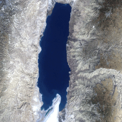
The spatial dimension will refer primarily to the Dead Sea Basin watershed. However, for certain issues the project team will need to consider driving factors outside the basin, because many of these are determined outside the study area (e.g. the demand for water in the urban centers of the three countries that are all far away of the area, the abstraction of the upper riparian, the degree of political regional cooperation).
Key principles of this project’s approach are:
· to establish a systemic view of the issue (i.e. to identify the underlying causes of interactions of the physical, economic and social subsystems)
· to understand the current situation that has led to the unsustainable situation (and the driving forces behind this) in order to be able to identify options for change
· to employ a jointly agreed scientific and rational view of the water resources and their use in the Dead Sea Basin
· to address the Dead Sea Basin as a whole (rather than to address it as parts of three countries)
· to freely exchange all project relevant information between the project partners in order that partners from one country understand the situation in the other countries
· to present all scientific results in a format that is applicable for decision making processes
|